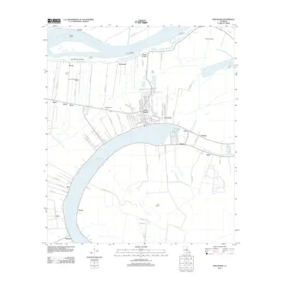
2012 Map of New Roads
USGS Topo · Published 2012About this map
False River, an oxbow lake formed from a former meander of the Mississippi River, dominates this portion of the Louisiana landscape. Along its northern shoreline, the settlement of New Roads serves as a hub of activity, where a dense network of streets like Saint Mary St and Napoleon St meet the water. The map documents a blend of traditional riverbank settlements and modern infrastructure, including the False River Regional Airport located just west of town. Moving away from the main town center, smaller locales such as Saint Dizier, Ventress, and Patin line the oxbow, illustrating the historical pattern of settlement along the fertile natural levees. Further south, the map identifies the notable Parlange area, while to the north, the active river channel is reinforced by the Arrow Bend Revetment and Red Store Landing Revetment.
Find a feature on this map
103 named features on this map. Tap any name to fly to it.
Don’t see what you’re looking for? This feature index may not catch every label — zoom into the map to look around manually.
Map Details
Editions of this 2012 New Roads Map
This is the sole edition of this map. No revisions or reprints were ever made.
Other maps of this area

1906 · Bayou Sara
USGS Topo · 1:125,000

1939 · St. Francisville
USGS Topo · 1:62,500

1939 · Fordoche
USGS Topo · 1:62,500

1941 · Batchelor
USGS Topo · 1:62,500

1953 · New Roads
USGS Topo · 1:24,000

1954 · Port Hudson
USGS Topo · 1:24,000

1954 · Walls
USGS Topo · 1:24,000

1954 · Elm Park
USGS Topo · 1:24,000

1954 · Fordoche
USGS Topo · 1:24,000

1954 · Erwinville
USGS Topo · 1:24,000