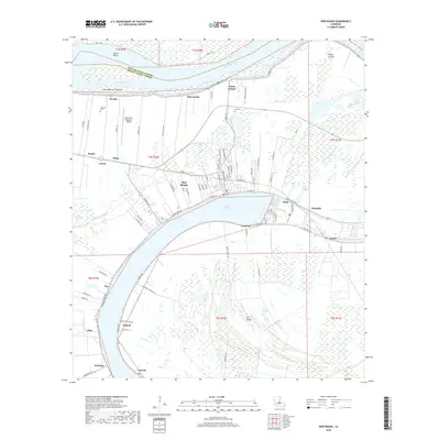
2018 Map of New Roads
USGS Topo · Published 2018About this map
New Roads serves as the focal point of this survey, situated on the northern shore of the False River, an oxbow lake formed from a former meander of the Mississippi River. The map captures the unique geography of this riverine landscape, where the alluvial land within the river's curve is identified as The Island. Settlement patterns follow the high ground and the arc of the water, with communities like Ventress, Patin, and Wickliffe lining the banks. To the north, the active river channel at Arrow Bend and Saint Maurice Towhead reveals the dynamic nature of the parish boundary between West Feliciana Parish and Pointe Coupee Parish. Inland, the terrain transitions into the Grand Swamp, while landmarks such as Parlange and Zion Cem provide specific points of interest for those tracing local family history or land ownership in this Louisiana delta region.
Find a feature on this map
100 named features on this map. Tap any name to fly to it.
Don’t see what you’re looking for? This feature index may not catch every label — zoom into the map to look around manually.
Map Details
Editions of this 2018 New Roads Map
This is the sole edition of this map. No revisions or reprints were ever made.
Other maps of this area

1906 · Bayou Sara
USGS Topo · 1:125,000

1939 · St. Francisville
USGS Topo · 1:62,500

1939 · Fordoche
USGS Topo · 1:62,500

1941 · Batchelor
USGS Topo · 1:62,500

1953 · New Roads
USGS Topo · 1:24,000

1954 · Port Hudson
USGS Topo · 1:24,000

1954 · Walls
USGS Topo · 1:24,000

1954 · Elm Park
USGS Topo · 1:24,000

1954 · Fordoche
USGS Topo · 1:24,000

1954 · Erwinville
USGS Topo · 1:24,000