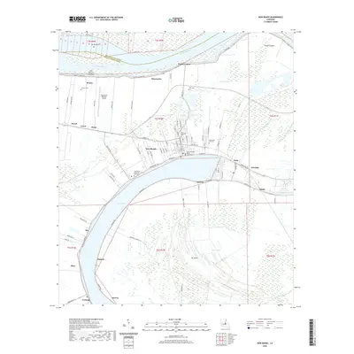
2020 Map of New Roads
USGS Topo · Published 2020About this map
New Roads serves as the focal point of this region, situated along the northern arc of the oxbow lake known as False River. The town's grid is anchored by the Pointe Coupee Parish Courthouse and a cluster of historic burial grounds, including Saint Augustine Cem and Saint Marys Cem. The landscape reflects the unique geography of the Mississippi River floodplain, where the river's former course created The Island, a large interior tract bounded by the oxbow and the modern Mississippi River channel to the north. Smaller settlements like Ventress, Jarreau, and Mix line the fertile banks of the old river loop, connected by a network of local roads such as Hospital Rd and Ferry Rd. This contemporary survey also shows the modern infrastructure of the False River Regional Airport and the expansive Grand Swamp to the south, illustrating how the natural hydrology continues to dictate the patterns of human habitation and transit in Pointe Coupee Parish.
Find a feature on this map
102 named features on this map. Tap any name to fly to it.
Don’t see what you’re looking for? This feature index may not catch every label — zoom into the map to look around manually.
Map Details
Editions of this 2020 New Roads Map
This is the sole edition of this map. No revisions or reprints were ever made.
Other maps of this area

1906 · Bayou Sara
USGS Topo · 1:125,000

1939 · St. Francisville
USGS Topo · 1:62,500

1939 · Fordoche
USGS Topo · 1:62,500

1941 · Batchelor
USGS Topo · 1:62,500

1953 · New Roads
USGS Topo · 1:24,000

1954 · Port Hudson
USGS Topo · 1:24,000

1954 · Walls
USGS Topo · 1:24,000

1954 · Elm Park
USGS Topo · 1:24,000

1954 · Fordoche
USGS Topo · 1:24,000

1954 · Erwinville
USGS Topo · 1:24,000