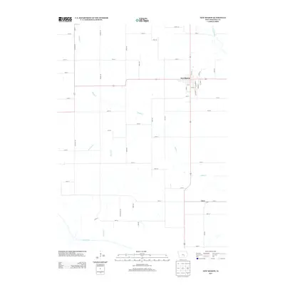
2013 Map of New Sharon
USGS Topo · Published 2013About this map
New Sharon anchors this agricultural landscape in Mahaska County, centered at the crossroads of Highway 63 and 102. The town's grid is detailed down to streets like E Depot St and S Railroad St, reflecting the historic influence of rail corridors on the local development pattern. Outside the town center, the terrain is defined by a dense network of drainage, where Middle Cr and Ballinger Cr wind through the sections toward the S Skunk River in the south. The small settlement of Lacey sits at the intersection of 175th Street and Highway 63, serving as a secondary point of interest in this rural township. The mapping reveals a highly structured section-line road system, including Galeston Ave and Maize Dr, which delineates the productive farmland between the North and South Skunk River drainages.
Find a feature on this map
45 named features on this map. Tap any name to fly to it.
Don’t see what you’re looking for? This feature index may not catch every label — zoom into the map to look around manually.
Map Details
Editions of this 2013 New Sharon Map
This is the sole edition of this map. No revisions or reprints were ever made.
Other maps of this area

1910 · Pella
USGS Topo · 1:62,500

1912 · Pella
USGS Topo · 1:62,500

1954 · Des Moines
USGS Topo · 1:250,000

1956 · Des Moines
USGS Topo · 1:250,000

1957 · Des Moines
USGS Topo · 1:250,000

1968 · University Park
USGS Topo · 1:24,000

1968 · Oskaloosa
USGS Topo · 1:24,000

1969 · Des Moines
USGS Topo · 1:250,000

1979 · Montezuma
USGS Topo · 1:24,000

1979 · Searsboro
USGS Topo · 1:24,000