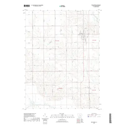
2018 Map of New Sharon
USGS Topo · Published 2018About this map
The town of New Sharon serves as the primary hub of this Mahaska County landscape, where the grid of agricultural roads meets the winding course of the North Skunk River and South Skunk River. This 2018 survey documents a region defined by its rural heritage, with numerous family and community burial grounds scattered across the townships. Genealogists can identify specific locations such as Highland Cem, Friends Cem, Weatherwax Cem, and Jackson Cem, which anchor the history of early settlement families. To the south, the small community of Lacey sits near the crossing of 175th St and the township line. The drainage patterns of Middle Cr, Ballinger Cr, and Mitchell Cr carve subtle valleys into the surrounding farmland, illustrating the relationship between the prairie hydrology and the persistent rectangular survey system that defines the local road network.
Find a feature on this map
56 named features on this map. Tap any name to fly to it.
Don’t see what you’re looking for? This feature index may not catch every label — zoom into the map to look around manually.
Map Details
Editions of this 2018 New Sharon Map
This is the sole edition of this map. No revisions or reprints were ever made.
Other maps of this area

1910 · Pella
USGS Topo · 1:62,500

1912 · Pella
USGS Topo · 1:62,500

1954 · Des Moines
USGS Topo · 1:250,000

1956 · Des Moines
USGS Topo · 1:250,000

1957 · Des Moines
USGS Topo · 1:250,000

1968 · University Park
USGS Topo · 1:24,000

1968 · Oskaloosa
USGS Topo · 1:24,000

1969 · Des Moines
USGS Topo · 1:250,000

1979 · Montezuma
USGS Topo · 1:24,000

1979 · Searsboro
USGS Topo · 1:24,000