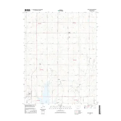
2015 Map of New Strawn
USGS Topo · Published 2015About this map
New Strawn and the surrounding Coffey County countryside are defined by the expansive Coffey County Lake, which dominates the southern landscape of this 2015 survey. The town of New Strawn sits on the western shore of the reservoir, while the Coffey County Airport lies just to the north, serving the regional aviation needs of the area. This modern survey illustrates the transition from traditional agricultural land use to infrastructure supporting the nearby cooling lake, yet it preserves the locations of several community landmarks.
Find a feature on this map
65 named features on this map. Tap any name to fly to it.
Don’t see what you’re looking for? This feature index may not catch every label — zoom into the map to look around manually.
Map Details
Editions of this 2015 New Strawn Map
This is the sole edition of this map. No revisions or reprints were ever made.
Other maps of this area

1885 · Burlington
USGS Topo · 1:125,000

1894 · Burlington
USGS Topo · 1:125,000

1947 · Lawrence
USGS Topo · 1:250,000

1950 · Lawrence
USGS Topo · 1:250,000

1956 · Lawrence
USGS Topo · 1:250,000

1957 · Lebo
USGS Topo · 1:24,000

1957 · Waverly NW
USGS Topo · 1:24,000

1957 · Waverly
USGS Topo · 1:24,000

1961 · Lawrence
USGS Topo · 1:250,000
1966 · John Redmond Dam
USGS Topo · 1:24,000