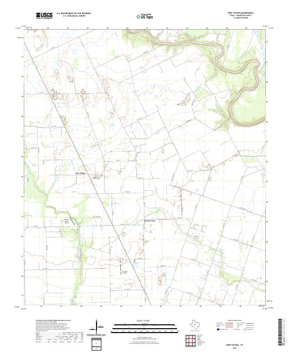
2022 Map of New Taiton
USGS Topo · Published 2022About this map
The coastal prairie of Wharton County is defined by a dense grid of farm roads and intermittent waterways feeding the Colorado River, which meanders through the northeast corner of this survey. The small settlement of New Taiton serves as a local anchor, centered near the Saint John Nepomucene Catholic Cem. The landscape is predominantly agricultural, shaped by drainage features like Mott Slough and Dobb Slough, which illustrate the flat, low-lying nature of this region. Private aviation is a notable characteristic of the area's modern spatial organization, with both the Rodgers Roost Airport and El Campo Airpark situated among the fields. Small clusters of homes near the community of Jones Creek and along farm-to-market roads like FM 961 reflect the persistent rural residential patterns of southeast Texas.
Find a feature on this map
53 named features on this map. Tap any name to fly to it.
Don’t see what you’re looking for? This feature index may not catch every label — zoom into the map to look around manually.
Map Details
Editions of this 2022 New Taiton Map
This is the sole edition of this map. No revisions or reprints were ever made.
Other maps of this area

1952 · Pierce
USGS Topo · 1:24,000

1952 · Egypt
USGS Topo · 1:24,000

1953 · Glen Flora
USGS Topo · 1:24,000

1953 · Seguin
USGS Topo · 1:250,000

1958 · Seguin
USGS Topo · 1:250,000

1959 · Garwood
USGS Topo · 1:24,000

1959 · Bonus
USGS Topo · 1:24,000

1960 · New Taiton
USGS Topo · 1:24,000

1965 · El Campo
USGS Topo · 1:24,000

1965 · Gobbler Creek
USGS Topo · 1:24,000