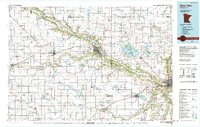
1991 Map of New Ulm
USGS Topo · Published 1991About this map
New Ulm and the deep valley of the Minnesota River anchor this 1991 compilation, showcasing a landscape defined by its glacial heritage and agricultural development. The map details the intricate network of watercourses that feed the main valley, including the Cottonwood River and the Little Cottonwood River, alongside numerous prairie lakes such as Swan Lake and Lake Hanska. These water bodies are often protected within conservation areas like the Swan Lake State WMA and Mulligan State WMA, reflecting the region's commitment to preserving wildlife habitats amidst sprawling township grids.
Find a feature on this map
167 named features on this map. Tap any name to fly to it.
Don’t see what you’re looking for? This feature index may not catch every label — zoom into the map to look around manually.
Map Details
Editions of this 1991 New Ulm Map
This is the sole edition of this map. No revisions or reprints were ever made.
Other maps of this area

1950 · Mankato East
USGS Topo · 1:62,500

1951 · Mankato East
USGS Topo · 1:62,500

1951 · Mankato West
USGS Topo · 1:62,500

1952 · Morton
USGS Topo · 1:62,500

1952 · Redwood Falls
USGS Topo · 1:62,500

1953 · Morgan
USGS Topo · 1:62,500

1953 · Saint Paul
USGS Topo · 1:250,000

1953 · New Ulm
USGS Topo · 1:250,000

1954 · Fairmont
USGS Topo · 1:250,000

1954 · Mason City
USGS Topo · 1:250,000