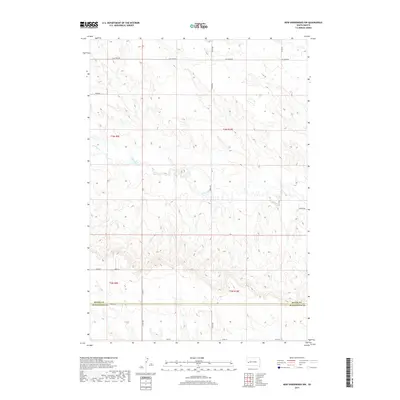
2017 Map of New Underwood NW
USGS Topo · Published 2017About this map
The county boundary between Meade Co and Pennington Co bisects this West River landscape, defined by the winding course of Elk Creek. This drainage system, which includes the seasonal waters of Antelope Cr, carves a series of draws and ridges through the high plains north of New Underwood. The township and range lines for t3n r9e, t3n r10e, t2n r9e, and t2n r10e provide the grid for a sparsely settled agricultural region. The network of section-line roads, such as Elk Creek Rd and Brehm Rd, reflects the rectilinear land division common in the Dakotas. A few local corridors like Bend Rd and Pioneer Rd deviate from the cardinal directions to follow the local topography, marking the routes of rural transit across the prairie.
Find a feature on this map
20 named features on this map. Tap any name to fly to it.
Don’t see what you’re looking for? This feature index may not catch every label — zoom into the map to look around manually.
Map Details
Editions of this 2017 New Underwood NW Map
This is the sole edition of this map. No revisions or reprints were ever made.
Other maps of this area

1893 · Rapid
USGS Topo · 1:125,000

1898 · Rapid
USGS Topo · 1:125,000

1903 · Rapid
USGS Topo · 1:125,000

1953 · Bend
USGS Topo · 1:24,000

1953 · Viewfield
USGS Topo · 1:24,000

1953 · Hereford SE
USGS Topo · 1:24,000

1953 · Boxelder
USGS Topo · 1:24,000

1953 · New Underwood
USGS Topo · 1:24,000

1953 · New Underwood SW
USGS Topo · 1:24,000

1953 · Hereford SW
USGS Topo · 1:24,000