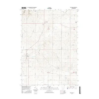
2015 Map of New Vienna
USGS Topo · Published 2015About this map
New Vienna and the neighboring settlements of Luxemburg and Holy Cross anchor this portion of Dubuque County, where the agricultural grid meets the dissected valley of the N Fork Maquoketa River. The landscape is defined by its deep Catholic heritage, evidenced by the central placement of Saint Boniface Cem and Holy Trinity Cem. These sites, along with the secluded Fagen Property Cem, provide critical touchpoints for genealogists researching the German-Catholic migration patterns of the region.
Find a feature on this map
54 named features on this map. Tap any name to fly to it.
Don’t see what you’re looking for? This feature index may not catch every label — zoom into the map to look around manually.
Map Details
Editions of this 2015 New Vienna Map
This is the sole edition of this map. No revisions or reprints were ever made.
Other maps of this area

1900 · Anamosa
USGS Topo · 1:125,000

1900 · Lancaster
USGS Topo · 1:125,000

1901 · Peosta
USGS Topo · 1:125,000

1902 · Elkader
USGS Topo · 1:125,000

1904 · Lancaster
USGS Topo · 1:125,000

1908 · Lancaster
USGS Topo · 1:125,000

1955 · Cassville
USGS Topo · 1:24,000

1957 · Turkey River
USGS Topo · 1:24,000

1957 · Colesburg
USGS Topo · 1:24,000

1957 · Holy Cross
USGS Topo · 1:24,000