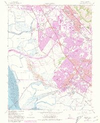
1959 Map of Newark
USGS Topo · Published 1981About this map
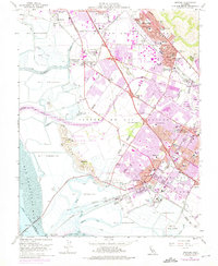
The vast Salt Evaporators of southern Alameda County dominate the shoreline in this mid-century survey, illustrating the industrial-scale salt production that defined the San Francisco Bay's eastern edge. Inland, the rapid post-war urbanization of the East Bay is evident as the Nimitz Freeway cuts through emerging residential districts. The map documents a critical period of consolidation for local identities, showing Union City (Alvarado), Union City (Decoto), and Fremont (Centerville District) as their historic cores begin to merge into a continuous suburban landscape.
Find a feature on this map
66 named features on this map. Tap any name to fly to it.
Don’t see what you’re looking for? This feature index may not catch every label — zoom into the map to look around manually.
Map Details
Editions of this 1959 Newark Map
6 editions found
Other maps of this area

1889 · San Jose
USGS Topo · 1:62,500

1897 · San Jose
USGS Topo · 1:62,500

1897 · Palo Alto
USGS Topo · 1:62,500

1899 · San Jose
USGS Topo · 1:62,500

1899 · Palo Alto
USGS Topo · 1:62,500

1899 · Haywards
USGS Topo · 1:62,500

1902 · Santa Cruz
USGS Topo · 1:125,000

1906 · Pleasanton
USGS Topo · 1:62,500

1915 · Haywards
USGS Topo · 1:62,500

1941 · Pleasanton
USGS Topo · 1:62,500