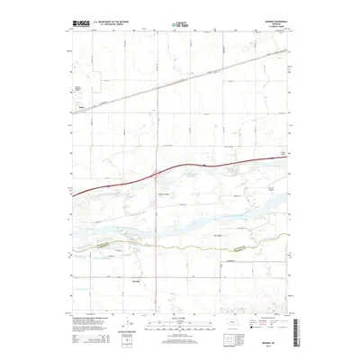
2014 Map of Newark
USGS Topo · Published 2014About this map
The braided channels of the Platte River dominate this central Nebraska landscape, defining the border between Buffalo and Kearney counties. The river separates into the North Channel Platte River, Middle Channel Platte River, and S Channel Platte River, creating a complex network of landmasses including Killgore Island, Elm Island, and Fort Far Island. This riparian environment is shaped by both natural waterways and man-made drainage systems like Whisky Slough and the Crooked Cr Drainage Ditch.
Find a feature on this map
45 named features on this map. Tap any name to fly to it.
Don’t see what you’re looking for? This feature index may not catch every label — zoom into the map to look around manually.
Map Details
Editions of this 2014 Newark Map
This is the sole edition of this map. No revisions or reprints were ever made.
Other maps of this area

1894 · Kearney
USGS Topo · 1:62,500

1894 · Minden
USGS Topo · 1:62,500

1896 · Kearney
USGS Topo · 1:125,000

1896 · Wood River
USGS Topo · 1:125,000

1955 · Grand Island
USGS Topo · 1:250,000

1957 · Grand Island
USGS Topo · 1:250,000

1958 · Grand Island
USGS Topo · 1:250,000

1962 · Newark
USGS Topo · 1:24,000
1962 · Pleasanton SE
USGS Topo · 1:24,000
1962 · Kearney
USGS Topo · 1:24,000