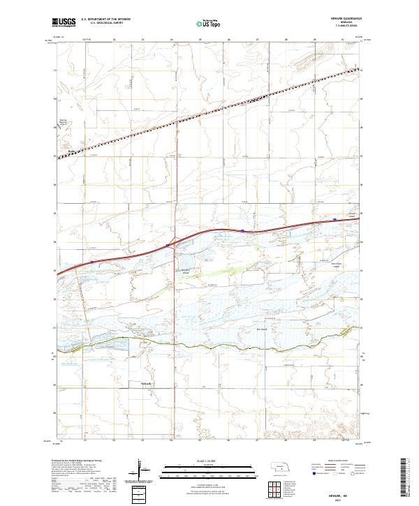
2021 Map of Newark
USGS Topo · Published 2021About this map
The complex braided system of the Middle Channel Platte River and its accompanying north and south channels dominates this portion of the Buffalo and Kearney county line. This intricate riverine landscape is punctuated by significant landmasses like Killgore Island and Fort Farm Island, which illustrate the shifting hydrography of the Nebraska plains. The settlement of Newark sits south of the river system, while Buda is positioned to the northwest near the Kearney Regional Airport. Modern recreation and land management are visible through the Fort-Kearney-Hike-Bike-Trl and drainage infrastructure such as the Crooked Cr Drainage Ditch and the evocatively named Whisky Slough. The grid of rural roads, including Elm Island Rd and Kilgore Rd, provides a framework for the agricultural activity surrounding the tiny community of Elm Island.
Find a feature on this map
37 named features on this map. Tap any name to fly to it.
Don’t see what you’re looking for? This feature index may not catch every label — zoom into the map to look around manually.
Map Details
Editions of this 2021 Newark Map
This is the sole edition of this map. No revisions or reprints were ever made.
Other maps of this area

1894 · Kearney
USGS Topo · 1:62,500

1894 · Minden
USGS Topo · 1:62,500

1896 · Kearney
USGS Topo · 1:125,000

1896 · Wood River
USGS Topo · 1:125,000

1955 · Grand Island
USGS Topo · 1:250,000

1957 · Grand Island
USGS Topo · 1:250,000

1958 · Grand Island
USGS Topo · 1:250,000

1962 · Newark
USGS Topo · 1:24,000
1962 · Pleasanton SE
USGS Topo · 1:24,000
1962 · Kearney
USGS Topo · 1:24,000