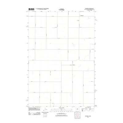
2012 Map of Newark
USGS Topo · Published 2012About this map
Brampton and Newark anchor this prairie landscape along the North Dakota-South Dakota border during the early 21st century. The map provides a detailed view of the rural township structure, defined by a rigid grid of numbered section roads such as 98th St SE and 125th Ave SE. For those researching local roots, the Brampton Cem serves as a primary genealogical landmark situated just south of the main settlement. The terrain is characterized by numerous small, scattered wetlands and depressions typical of the regional topography, often situated away from the primary thoroughfares like Newark Rd. This survey documents a quiet agricultural region where the placement of farmsteads and rural infrastructure remains tied to the original land survey patterns established over a century prior.
Find a feature on this map
27 named features on this map. Tap any name to fly to it.
Don’t see what you’re looking for? This feature index may not catch every label — zoom into the map to look around manually.
Map Details
Editions of this 2012 Newark Map
This is the sole edition of this map. No revisions or reprints were ever made.
Other maps of this area

1953 · Britton East
USGS Topo · 1:24,000

1953 · Newark SW
USGS Topo · 1:24,000

1953 · Kidder
USGS Topo · 1:24,000

1953 · Newark
USGS Topo · 1:24,000

1953 · Milbank
USGS Topo · 1:250,000

1953 · Fargo
USGS Topo · 1:250,000

1956 · Fargo
USGS Topo · 1:250,000
1956 · Straubville
USGS Topo · 1:24,000

1956 · Britton West
USGS Topo · 1:24,000

1956 · Newark NW
USGS Topo · 1:24,000