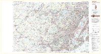
1984 Map of Newark
USGS Topo · Published 1985About this map
The Watchung Mountains and the dense urban corridor of northern New Jersey dominate this mid-1980s topographic survey. Anchored by the major industrial and transit hubs of Newark, Jersey City, and Paterson, the map documents a landscape defined by its complex waterways and infrastructure. The Passaic River and Hackensack River flow into the vital shipping channels of Newark Bay, while the Hudson River separates the mainland from Manhattan. Iconic landmarks like the Statue of Liberty National Monument and Ellis Island sit at the mouth of the harbor, serving as a gateway to the region.
Find a feature on this map
230 named features on this map. Tap any name to fly to it.
Don’t see what you’re looking for? This feature index may not catch every label — zoom into the map to look around manually.
Map Details
Editions of this 1984 Newark Map
This is the sole edition of this map. No revisions or reprints were ever made.
Other maps of this area

1888 · Franklin
USGS Topo · 1:62,500

1888 · Plainfield
USGS Topo · 1:62,500

1888 · Morristown
USGS Topo · 1:62,500

1888 · Hackettstown
USGS Topo · 1:62,500

1888 · New Brunswick
USGS Topo · 1:62,500

1888 · Princeton
USGS Topo · 1:62,500

1888 · Lake Hopatcong
USGS Topo · 1:62,500

1888 · Paterson
USGS Topo · 1:62,500

1888 · Sandy Hook
USGS Topo · 1:62,500

1889 · Brooklyn
USGS Topo · 1:62,500