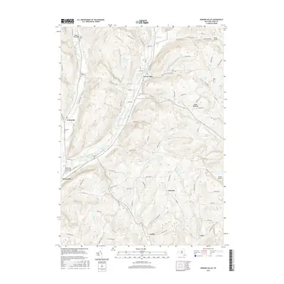
2016 Map of Newark Valley
USGS Topo · Published 2016About this map
Newark Valley sits at the confluence of several prominent drainages, where the East Branch Owego Creek and West Branch Owego Creek carve deep valleys through the Southern Tier highlands. This modern topographical survey shows a landscape of clustered hamlets and narrow hollows, connected by a network of rural routes like Wade Hollow Rd and Foster Valley Rd. The area's long-established settlement pattern is evident in its numerous small burial grounds, including Searlestown Cem, Hope Cem, and the remote Settle Cem on the eastern hills. Local landmarks such as the West Creek Road Bridge and named water bodies like Alexander Lake and Holden Pond mark the transition from agricultural valley floors to the high ridges of Prentice Hill and Howard Hill.
Find a feature on this map
87 named features on this map. Tap any name to fly to it.
Don’t see what you’re looking for? This feature index may not catch every label — zoom into the map to look around manually.
Map Details
Editions of this 2016 Newark Valley Map
This is the sole edition of this map. No revisions or reprints were ever made.
Other maps of this area

1900 · Dryden
USGS Topo · 1:62,500

1901 · Apalachin
USGS Topo · 1:62,500

1903 · Owego
USGS Topo · 1:62,500

1903 · Harford
USGS Topo · 1:62,500

1904 · Apalachin
USGS Topo · 1:62,500

1906 · Catatonk
USGS Topo · 1:125,000

1949 · Speedsville
USGS Topo · 1:24,000
1949 · Lisle
USGS Topo · 1:24,000

1950 · Elmira
USGS Topo · 1:250,000
1950 · Richford
USGS Topo · 1:24,000