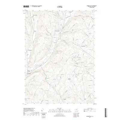
2019 Map of Newark Valley
USGS Topo · Published 2019About this map
Newark Valley sits at the confluence of several glacial valleys in Tioga County, where the East Branch Owego Creek and West Branch Owego Creek define the landscape's orientation. The settlement pattern follows these watercourses, with communities like Flemingville and Weltonville established along the valley floors. High ridges like Prentice Hill and Courtright Hill separate these drainages, creating a series of north-south corridors that have dictated local transport for generations. The map reveals a high density of small family and community burial grounds, including West Newark Cem, Saint Johns Cem, and Hope Cem, reflecting the deep-rooted genealogical history of these rural townships. Near the southern edge, the West Creek Road Bridge stands as a notable landmark where local infrastructure crosses the winding creek systems that eventually feed the Susquehanna River basin.
Find a feature on this map
107 named features on this map. Tap any name to fly to it.
Don’t see what you’re looking for? This feature index may not catch every label — zoom into the map to look around manually.
Map Details
Editions of this 2019 Newark Valley Map
This is the sole edition of this map. No revisions or reprints were ever made.
Other maps of this area

1900 · Dryden
USGS Topo · 1:62,500

1901 · Apalachin
USGS Topo · 1:62,500

1903 · Owego
USGS Topo · 1:62,500

1903 · Harford
USGS Topo · 1:62,500

1904 · Apalachin
USGS Topo · 1:62,500

1906 · Catatonk
USGS Topo · 1:125,000

1949 · Speedsville
USGS Topo · 1:24,000
1949 · Lisle
USGS Topo · 1:24,000

1950 · Elmira
USGS Topo · 1:250,000
1950 · Richford
USGS Topo · 1:24,000