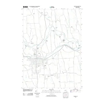
2010 Map of Newark
USGS Topo · Published 2010About this map
Newark and the surrounding township of Arcadia are defined by the historic corridor of the Erie Canal, which cuts through the heart of the landscape. This 2010 survey illustrates a region where established agricultural heritage persists alongside the central village, evidenced by numerous family-named properties such as Bodine Farm, Lehigh Farms, and Peacework Organic Farm. The drainage of Ganargua Creek and its tributaries like Butternut Run shaped the early industry and settlement patterns of locations like Mud Mills and Hydesville. For genealogists and local historians, the map is particularly useful for its detailed locations of several community burial grounds, including the Old Houser Cemetery, Fairville Cemetery, and Lyons Rural Cemetery. To the south, the settlement of Marbletown and the rising elevations of Bailey Hill and Jackson Hill mark the transition toward more varied terrain away from the canal valley.
Find a feature on this map
115 named features on this map. Tap any name to fly to it.
Don’t see what you’re looking for? This feature index may not catch every label — zoom into the map to look around manually.
Map Details
Editions of this 2010 Newark Map
This is the sole edition of this map. No revisions or reprints were ever made.
Other maps of this area

1899 · Palmyra
USGS Topo · 1:62,500

1902 · Geneva
USGS Topo · 1:62,500

1902 · Clyde
USGS Topo · 1:62,500

1902 · Phelps
USGS Topo · 1:62,500

1902 · Palmyra
USGS Topo · 1:62,500

1943 · Lyons
USGS Topo · 1:31,680

1943 · Geneva North
USGS Topo · 1:31,680

1943 · Phelps
USGS Topo · 1:31,680

1943 · Williamson
USGS Topo · 1:31,680

1943 · Sodus
USGS Topo · 1:31,680