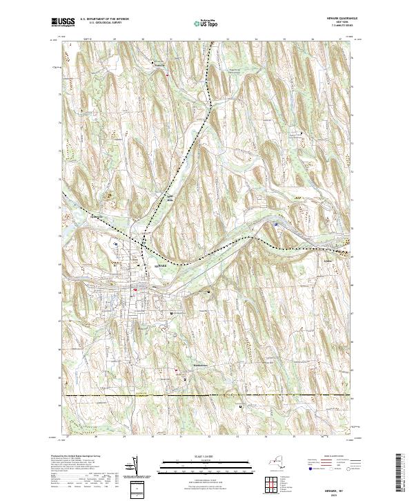
2023 Map of Newark
USGS Topo · Published 2023About this map
The Erie Canal cuts a definitive path through the heart of this Wayne County landscape, connecting the industrial and residential centers of Newark and Lyons. This corridor follows the natural drainage of Ganargua Creek and the Canandaigua Outlet, illustrating the 19th-century engineering that utilized river valleys to facilitate westward transport. The surrounding terrain is defined by distinctive glacial drumlins, including Bailey Hill, Silver Hill, and Jackson Hill, which dictate the winding paths of rural roads and the placement of early settlements.
Find a feature on this map
141 named features on this map. Tap any name to fly to it.
Don’t see what you’re looking for? This feature index may not catch every label — zoom into the map to look around manually.
Map Details
Editions of this 2023 Newark Map
This is the sole edition of this map. No revisions or reprints were ever made.
Other maps of this area

1899 · Palmyra
USGS Topo · 1:62,500

1902 · Geneva
USGS Topo · 1:62,500

1902 · Clyde
USGS Topo · 1:62,500

1902 · Phelps
USGS Topo · 1:62,500

1902 · Palmyra
USGS Topo · 1:62,500

1943 · Lyons
USGS Topo · 1:31,680

1943 · Geneva North
USGS Topo · 1:31,680

1943 · Phelps
USGS Topo · 1:31,680

1943 · Williamson
USGS Topo · 1:31,680

1943 · Sodus
USGS Topo · 1:31,680