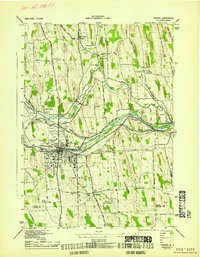
1943 Map of Newark
USGS Topo · Published 1943About this map
The Barge Canal and the legacy of the Abd Erie Canal dominate this industrial and agricultural corridor between Newark and Lyons during the early 1940s. The landscape is a complex network of transportation, where the New York Central RR and Pennsylvania RR intersect with historic water routes. Significant local institutions are prominently mapped, including the sprawling grounds of the Newark State School and the County Home. Smaller settlements like Fairville Sta, Mud Mills, and Hydesville appear alongside a dense distribution of numbered rural schools such as School No 13 and School No 22. The terrain is characterized by the drumlins of Wayne County, notably Silver Hill, while cultural landmarks like the Lyons Rural Cem and the Airway Beacon near the local Airport reflect the era's infrastructure.
Find a feature on this map
73 named features on this map. Tap any name to fly to it.
Don’t see what you’re looking for? This feature index may not catch every label — zoom into the map to look around manually.
Map Details
Editions of this 1943 Newark Map
This is the sole edition of this map. No revisions or reprints were ever made.
Other maps of this area

1899 · Palmyra
USGS Topo · 1:62,500

1902 · Geneva
USGS Topo · 1:62,500

1902 · Clyde
USGS Topo · 1:62,500

1902 · Phelps
USGS Topo · 1:62,500

1902 · Palmyra
USGS Topo · 1:62,500

1943 · Lyons
USGS Topo · 1:31,680

1943 · Geneva North
USGS Topo · 1:31,680

1943 · Phelps
USGS Topo · 1:31,680

1943 · Williamson
USGS Topo · 1:31,680

1943 · Sodus
USGS Topo · 1:31,680