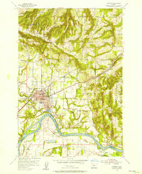
1954 Map of Newberg
USGS Topo · Published 1957About this map
The Willamette River anchors this 1950s survey of the north Willamette Valley, where Newberg serves as a central hub for the surrounding agricultural and timber lands. The landscape is defined by the significant rise of the Chehalem Mountains to the north and Parrett Mountain to the east, with small rural centers like Springbrook and Rex situated along the Southern Pacific rail line. Near the river's bend, Ash Island and the Logging Pond highlight the importance of the water for both navigation and industry.
Find a feature on this map
52 named features on this map. Tap any name to fly to it.
Don’t see what you’re looking for? This feature index may not catch every label — zoom into the map to look around manually.
Map Details
Editions of this 1954 Newberg Map
This is the sole edition of this map. No revisions or reprints were ever made.
Other maps of this area

1916 · Tualatin
USGS Topo · 1:62,500

1923 · Mount Angel
USGS Topo · 1:62,500

1924 · Mc Minnville
USGS Topo · 1:48,000

1926 · Mc Minnville
USGS Topo · 1:62,500

1939 · Tualatin
USGS Topo · 1:62,500

1940 · McMinnville
USGS Topo · 1:62,500

1940 · Tualatin
USGS Topo · 1:62,500

1940 · Mount Angel
USGS Topo · 1:62,500

1941 · Yamhill
USGS Topo · 1:62,500

1942 · Yamhill
USGS Topo · 1:62,500