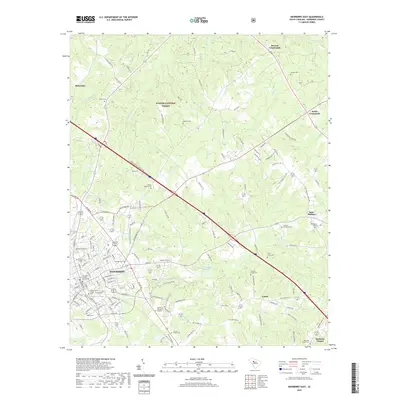
2020 Map of Newberry East
USGS Topo · Published 2020About this map
The historic seat of Newberry County serves as the western anchor of this survey, where the campus of Newberry College and the Newberry County Courthouse mark the center of local civic life. Moving east, the landscape transitions from the dense street grids of Newberry into the expansive pine and hardwood stands of the Sumter National Forest. This rural terrain is defined by a high density of early burial grounds and crossroads communities, such as Keitts Crossroads and Browns Crossroads, which suggest a long-established pattern of settlement along the ridges between watercourses like Hellers Cr and Cannons Cr.
Find a feature on this map
147 named features on this map. Tap any name to fly to it.
Don’t see what you’re looking for? This feature index may not catch every label — zoom into the map to look around manually.
Map Details
Editions of this 2020 Newberry East Map
This is the sole edition of this map. No revisions or reprints were ever made.
Other maps of this area

1904 · Columbia
USGS Topo · 1:125,000

1941 · Spartanburg
USGS Topo · 1:250,000

1953 · Spartanburg
USGS Topo · 1:250,000

1960 · Spartanburg
USGS Topo · 1:250,000

1963 · Spartanburg
USGS Topo · 1:250,000

1964 · Spartanburg
USGS Topo · 1:250,000

1968 · Newberry East
USGS Topo · 1:24,000

1969 · Whitmire South
USGS Topo · 1:24,000

1969 · Pomaria
USGS Topo · 1:24,000

1969 · Blair
USGS Topo · 1:24,000