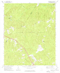
1969 Map of Newberry NW
USGS Topo · Published 1977About this map
Stomp Springs and the surrounding woodlands of the Sumter National Forest define this 1960s landscape along the border of Laurens and Newberry counties. The map captures a transitional rural economy where the tracks of the Seaboard Coast Line railroad parallel the old highways that intersect at local landmarks like Brickhouse Crossroads and Eison Crossroads. These junctions, along with Cromer Crossroads, served as the primary nodes for social and spiritual life, as evidenced by a network of country churches including Cedar Grove Ch, Flint Hill Ch, and Zion Ch. Numerous small waterways such as Duncan Creek and Headleys Creek drain the dissected terrain, while family-named features like Ned Wesson Branch and Asias Branch hint at the area's ancestral landholdings.
Find a feature on this map
30 named features on this map. Tap any name to fly to it.
Don’t see what you’re looking for? This feature index may not catch every label — zoom into the map to look around manually.
Map Details
Editions of this 1969 Newberry NW Map
2 editions found
Other maps of this area

1941 · Spartanburg
USGS Topo · 1:250,000

1953 · Spartanburg
USGS Topo · 1:250,000

1960 · Spartanburg
USGS Topo · 1:250,000

1963 · Spartanburg
USGS Topo · 1:250,000

1964 · Spartanburg
USGS Topo · 1:250,000

1968 · Newberry East
USGS Topo · 1:24,000

1969 · Whitmire South
USGS Topo · 1:24,000

1969 · Newberry NW
USGS Topo · 1:24,000

1969 · Sedalia
USGS Topo · 1:24,000
1969 · Philson Crossroads
USGS Topo · 1:24,000
Featured Places
- Stomp Springs, SC
- Eison Crossroads, SC
- Brickhouse Crossroads, SC
- Cromer Crossroads, SC
- Laurens County, SC