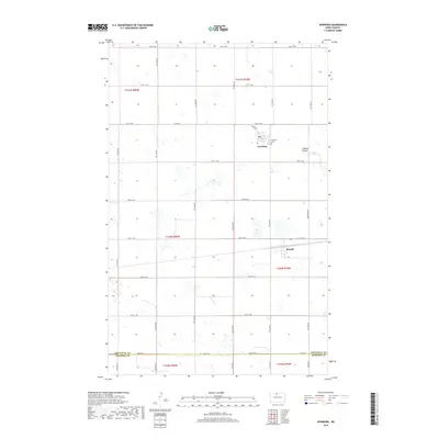
2017 Map of Newburg
USGS Topo · Published 2017About this map
Newburg and the small siding of Russell anchor this agricultural landscape in North Dakota's drift prairie. The survey captures the region's rectilinear section lines, defined by a network of gravel roads such as Co Rd 20 and 90th St NW. Evidence of past transportation shifts is visible in the Abandoned RR corridor that once served these grain-shipping communities. Genealogy and local history researchers can locate the Newburg Cem just north of the townsite. The terrain is marked by the LaPorte Coulee and numerous small prairie potholes, while the southern margin follows the Bottineau Co McHenry Co line. This 2017 edition preserves the spatial arrangement of the Public Land Survey System townships, including t161n r79w and t160n r79w, during a period of modern rural stability.
Find a feature on this map
23 named features on this map. Tap any name to fly to it.
Don’t see what you’re looking for? This feature index may not catch every label — zoom into the map to look around manually.
Map Details
Editions of this 2017 Newburg Map
This is the sole edition of this map. No revisions or reprints were ever made.
Other maps of this area

1948 · Newburg SW
USGS Topo · 1:24,000

1949 · Newburg SW
USGS Topo · 1:24,000

1949 · Eckman SE
USGS Topo · 1:24,000

1949 · Eckman
USGS Topo · 1:24,000

1949 · Landa SW
USGS Topo · 1:24,000

1950 · Newburg
USGS Topo · 1:24,000

1950 · Deep
USGS Topo · 1:24,000

1950 · Newburg SE
USGS Topo · 1:24,000

1950 · Landa SW
USGS Topo · 1:24,000

1951 · Westhope SE
USGS Topo · 1:24,000