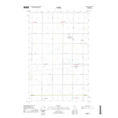
2020 Map of Newburg
USGS Topo · Published 2020About this map
Newburg and Russell anchor this agricultural landscape in North Dakota, where the grid of sections and section-line roads defines the rural economy. The presence of an Abandoned RR passing through Russell serves as a reminder of the rail-dependent transport networks that once vitalized these northern prairie settlements. This 2020 map documents a transition toward consolidated acreage, yet many of the foundational community landmarks remain central to the geography. Local genealogy and history are preserved through three primary burial sites: Newburg Cem, Dovre Lutheran Cem, and Russell Cem. Along the eastern edge of the survey, the LaPorte Coulee breaks the level terrain, providing natural drainage for the surrounding fields. The southern boundary is marked by the line dividing Bottineau Co and McHenry Co, tracing a administrative border across open farmland.
Find a feature on this map
25 named features on this map. Tap any name to fly to it.
Don’t see what you’re looking for? This feature index may not catch every label — zoom into the map to look around manually.
Map Details
Editions of this 2020 Newburg Map
This is the sole edition of this map. No revisions or reprints were ever made.
Other maps of this area

1948 · Newburg SW
USGS Topo · 1:24,000

1949 · Newburg SW
USGS Topo · 1:24,000

1949 · Eckman SE
USGS Topo · 1:24,000

1949 · Eckman
USGS Topo · 1:24,000

1949 · Landa SW
USGS Topo · 1:24,000

1950 · Newburg
USGS Topo · 1:24,000

1950 · Deep
USGS Topo · 1:24,000

1950 · Newburg SE
USGS Topo · 1:24,000

1950 · Landa SW
USGS Topo · 1:24,000

1951 · Westhope SE
USGS Topo · 1:24,000