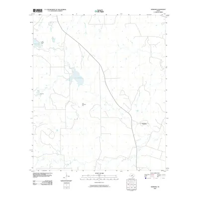
2010 Map of Newburg
USGS Topo · Published 2010About this map
The small community of Newburg sits within a landscape defined by the drainage of the South Leon River in central Texas. This 2010 topographic survey documents an area characterized by agricultural land use and significant water management infrastructure. Several man-made reservoirs dot the terrain, including Lake Comanche and Lake Eanes, both featuring identified dams that suggest a history of local water conservation and ranching support. The network of creeks, such as Moore Creek, Armstrong Creek, and Mercer Creek, crisscrosses the quadrangle, illustrating the natural watershed that feeds the larger river system. Smaller features like Bean Lake and Salt Branch further define the rural character of Comanche County, providing a clear record of the local geography as it existed at the start of the decade.
Find a feature on this map
15 named features on this map. Tap any name to fly to it.
Don’t see what you’re looking for? This feature index may not catch every label — zoom into the map to look around manually.
Map Details
Editions of this 2010 Newburg Map
This is the sole edition of this map. No revisions or reprints were ever made.
Other maps of this area

1888 · Hamilton
USGS Topo · 1:125,000

1889 · Brownwood
USGS Topo · 1:125,000

1894 · Hamilton
USGS Topo · 1:125,000

1894 · Brownwood
USGS Topo · 1:125,000

1931 · Mullin
USGS Topo · 1:62,500

1950 · Mullin
USGS Topo · 1:62,500

1954 · Brownwood
USGS Topo · 1:250,000

1956 · Gustine
USGS Topo · 1:62,500

1956 · Gustine
USGS Topo · 1:24,000

1956 · Pottsville
USGS Topo · 1:62,500