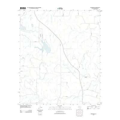
2013 Map of Newburg
USGS Topo · Published 2013About this map
The S Leon River flows across the southern reaches of this Comanche County landscape, defining a terrain shaped by the tributaries of the Leon watershed. In the early 21st century, the settlement of Newburg remains the primary focal point of the area, situated at the junction of several rural roads. The landscape is dotted with several significant water bodies, most notably Lake Comanche and Lake Eanes, alongside smaller basins like Bean Lake. A network of numbered county roads and state highways, including FM-1476 and HWY-2561, provides access to the ranching and agricultural lands. Numerous named watercourses, such as Mercer Cr, Moore Cr, and Holmsley Cr, carve through the region, illustrating the intricate drainage patterns that support the local environment.
Find a feature on this map
37 named features on this map. Tap any name to fly to it.
Don’t see what you’re looking for? This feature index may not catch every label — zoom into the map to look around manually.
Map Details
Editions of this 2013 Newburg Map
This is the sole edition of this map. No revisions or reprints were ever made.
Other maps of this area

1888 · Hamilton
USGS Topo · 1:125,000

1889 · Brownwood
USGS Topo · 1:125,000

1894 · Hamilton
USGS Topo · 1:125,000

1894 · Brownwood
USGS Topo · 1:125,000

1931 · Mullin
USGS Topo · 1:62,500

1950 · Mullin
USGS Topo · 1:62,500

1954 · Brownwood
USGS Topo · 1:250,000

1956 · Gustine
USGS Topo · 1:62,500

1956 · Gustine
USGS Topo · 1:24,000

1956 · Pottsville
USGS Topo · 1:62,500