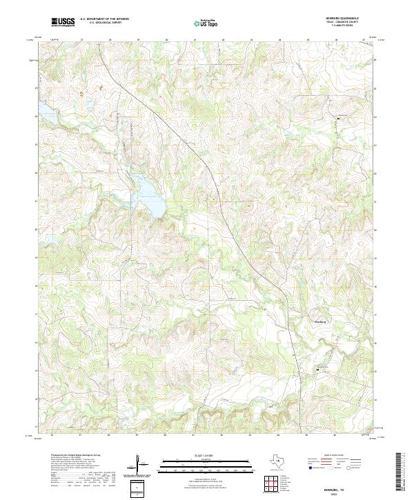
2022 Map of Newburg
USGS Topo · Published 2022About this map
Newburg sits as the central settlement in this Comanche County landscape, where the Leon River and its tributary S Leon River carve through the Texas terrain. The map reveals a rural geography defined by its water sources, including the prominent Lake Comanche and smaller bodies like Bean Lake and Lake Eanes. Local family history and genealogy are anchored by established sites such as Newburg Cem near the river and Shiloh Cem to the north along Holmsley Cr. The road network, comprising routes like FM 1476 and Ranch Rd 3200, connects scattered homesteads and property boundaries like Mercers Preserve Rd. The drainage patterns of Mercer Creek and Armstrong Cr illustrate the watershed that sustains this agricultural region.
Find a feature on this map
45 named features on this map. Tap any name to fly to it.
Don’t see what you’re looking for? This feature index may not catch every label — zoom into the map to look around manually.
Map Details
Editions of this 2022 Newburg Map
This is the sole edition of this map. No revisions or reprints were ever made.
Other maps of this area

1888 · Hamilton
USGS Topo · 1:125,000

1889 · Brownwood
USGS Topo · 1:125,000

1894 · Hamilton
USGS Topo · 1:125,000

1894 · Brownwood
USGS Topo · 1:125,000

1931 · Mullin
USGS Topo · 1:62,500

1950 · Mullin
USGS Topo · 1:62,500

1954 · Brownwood
USGS Topo · 1:250,000

1956 · Gustine
USGS Topo · 1:62,500

1956 · Gustine
USGS Topo · 1:24,000

1956 · Pottsville
USGS Topo · 1:62,500