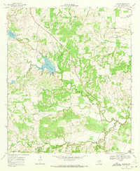
1969 Map of Newburg
USGS Topo · Published 1972About this map
Newburg sits along the southern edge of this landscape, positioned near the winding course of the South Leon River. The area in the late 1960s was defined by its water management and agricultural drainage, with Mercer Creek and its many tributaries, including Moose Creek and Horse Creek, carving through the terrain. The presence of Lake Comanche and Lake Eanes, the latter featuring a Filtration Plant and Lake Eanes Park, underscores the transition toward recreational and municipal water infrastructure. Local heritage is centered around rural landmarks like Shiloh Ch and South Leon Ch, along with several small Cem sites that serve as primary markers for genealogical research in this part of Comanche County.
Find a feature on this map
22 named features on this map. Tap any name to fly to it.
Don’t see what you’re looking for? This feature index may not catch every label — zoom into the map to look around manually.
Map Details
Editions of this 1969 Newburg Map
This is the sole edition of this map. No revisions or reprints were ever made.
Other maps of this area

1888 · Hamilton
USGS Topo · 1:125,000

1889 · Brownwood
USGS Topo · 1:125,000

1894 · Hamilton
USGS Topo · 1:125,000

1894 · Brownwood
USGS Topo · 1:125,000

1931 · Mullin
USGS Topo · 1:62,500

1950 · Mullin
USGS Topo · 1:62,500

1954 · Brownwood
USGS Topo · 1:250,000

1956 · Gustine
USGS Topo · 1:62,500

1956 · Gustine
USGS Topo · 1:24,000

1956 · Pottsville
USGS Topo · 1:62,500