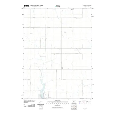
2010 Map of Newburg
USGS Topo · Published 2010About this map
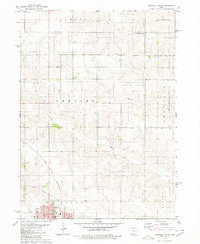
Rock Creek Lake dominates the southwestern corner of this Jasper and Marshall County landscape, where the waters of Rock Creek are impounded within a valley of agricultural fields. The settlement of Newburg sits centrally along the eastern border, positioned near the headwaters of Big Bear Creek. To the north, Gilman serves as a primary hub for the surrounding rural townships, connected by a network of gravel and paved roads such as Hwy T38 N and Hwy F17 E.
Find a feature on this map
39 named features on this map. Tap any name to fly to it.
Don’t see what you’re looking for? This feature index may not catch every label — zoom into the map to look around manually.
Map Details
Editions of this 2010 Newburg Map
This is the sole edition of this map. No revisions or reprints were ever made.
Other maps of this area

1954 · Des Moines
USGS Topo · 1:250,000

1956 · Des Moines
USGS Topo · 1:250,000

1957 · Des Moines
USGS Topo · 1:250,000

1969 · Des Moines
USGS Topo · 1:250,000

1979 · Grinnell South
USGS Topo · 1:24,000

1980 · Newburg
USGS Topo · 1:24,000
1980 · Montour
USGS Topo · 1:24,000
1980 · Gilman
USGS Topo · 1:24,000
1980 · Laurel
USGS Topo · 1:24,000
1980 · Grinnell North
USGS Topo · 1:24,000