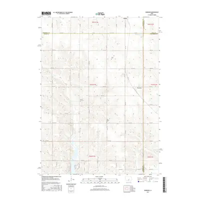
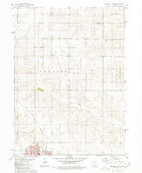
2015 Map of Newburg
USGS Topo · Published 2015About this map
Gilman sits at the northern edge of this agricultural landscape where the borders of Marshall, Jasper, Tama, and Poweshiek counties converge. This 2015 survey reveals a terrain defined by its watercourses and rural burial grounds, reflecting generations of settlement in central Iowa. In the southern reach of the quadrangle, Rock Creek Lake provides a significant hydrological landmark, fed by Rock Cr. The map preserves the locations of several historical cemeteries, including Hickory Grove Cem and Mount Pleasant Cem, which serve as vital points for genealogical research. The settlement of Newburg is positioned along the eastern border, tied to the local road network by routes such as Co HWY t38. The drainage patterns of Big Bear Cr, Sugar Cr, and Brush Cr illustrate the natural topography that has influenced the placement of farmsteads and rural infrastructure throughout the townships.
Find a feature on this map
41 named features on this map. Tap any name to fly to it.
Don’t see what you’re looking for? This feature index may not catch every label — zoom into the map to look around manually.
Map Details
Editions of this 2015 Newburg Map
This is the sole edition of this map. No revisions or reprints were ever made.
Other maps of this area

1954 · Des Moines
USGS Topo · 1:250,000

1956 · Des Moines
USGS Topo · 1:250,000

1957 · Des Moines
USGS Topo · 1:250,000

1969 · Des Moines
USGS Topo · 1:250,000

1979 · Grinnell South
USGS Topo · 1:24,000

1980 · Newburg
USGS Topo · 1:24,000
1980 · Montour
USGS Topo · 1:24,000
1980 · Gilman
USGS Topo · 1:24,000
1980 · Laurel
USGS Topo · 1:24,000
1980 · Grinnell North
USGS Topo · 1:24,000