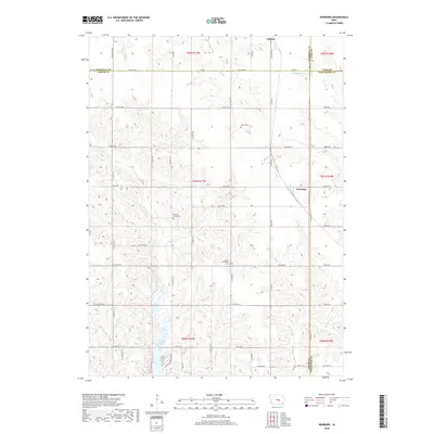
2018 Map of Newburg
USGS Topo · Published 2018About this map
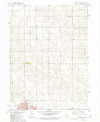
The town of Newburg and the southern edge of Gilman anchor this agricultural landscape at the meeting of four counties: Marshall, Jasper, Tama, and Poweshiek. The terrain is defined by the drainage basins of several waterways, including Rock Cr which feeds into the prominent Rock Creek Lake in the southwestern portion of the sheet. Other local streams like Sugar Cr, Big Bear Cr, and Brush Cr create a network of valleys across the prairie, influencing the grid of gravel and secondary roads such as Co HWY t38 and HWY f17 E. For researchers tracing family ties to the area, several local burial grounds are noted, including Green Cem, Hickory Grove Cem, and Mount Pleasant Cem. The presence of these landmarks alongside the lake and the established settlement at Newburg highlights the long-standing community structure of this rural central Iowa region.
Find a feature on this map
58 named features on this map. Tap any name to fly to it.
Don’t see what you’re looking for? This feature index may not catch every label — zoom into the map to look around manually.
Map Details
Editions of this 2018 Newburg Map
This is the sole edition of this map. No revisions or reprints were ever made.
Other maps of this area

1954 · Des Moines
USGS Topo · 1:250,000

1956 · Des Moines
USGS Topo · 1:250,000

1957 · Des Moines
USGS Topo · 1:250,000

1969 · Des Moines
USGS Topo · 1:250,000

1979 · Grinnell South
USGS Topo · 1:24,000

1980 · Newburg
USGS Topo · 1:24,000
1980 · Montour
USGS Topo · 1:24,000
1980 · Gilman
USGS Topo · 1:24,000
1980 · Laurel
USGS Topo · 1:24,000
1980 · Grinnell North
USGS Topo · 1:24,000