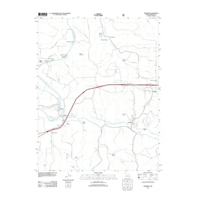
2012 Map of Newburg
USGS Topo · Published 2012About this map
Little Piney Creek meets the Gasconade River at a geographical crossroads where the towns of Arlington and Jerome grew along the riverbanks. This 2012 survey illustrates the deep-cut hollows and ridges characteristic of this Missouri landscape, featuring named terrain like Devils Backbone and Brick House Hollow. The map documents a cluster of settlements including Newburg, Doolittle, and Stony Dell, reflecting a historical transition from river-dependent crossings like Whitehouse Ford to the modern interstate corridor. Genealogists will find several family and community burial grounds, such as Ramsey Cemetery, Pillman Cemetery, and Kitchell Cemetery, situated among the winding forest roads and creek valleys. The detailed road network, from White House Ferry Rd to the streets of Newburg Heights, shows the enduring settlement patterns of Phelps County.
Find a feature on this map
72 named features on this map. Tap any name to fly to it.
Don’t see what you’re looking for? This feature index may not catch every label — zoom into the map to look around manually.
Map Details
Editions of this 2012 Newburg Map
This is the sole edition of this map. No revisions or reprints were ever made.
Other maps of this area

1888 · Tuscumbia
USGS Topo · 1:125,000

1894 · Tuscumbia
USGS Topo · 1:125,000

1912 · Rolla
USGS Topo · 1:62,500

1936 · Waynesville
USGS Topo · 1:48,000

1937 · Vienna
USGS Topo · 1:62,500

1938 · Vienna
USGS Topo · 1:48,000

1942 · Waynesville
USGS Topo · 1:62,500

1944 · Waynesville
USGS Topo · 1:62,500

1947 · Jefferson City
USGS Topo · 1:250,000

1948 · Tavern
USGS Topo · 1:62,500