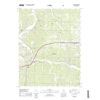
2017 Map of Newburg
USGS Topo · Published 2017About this map
The Gasconade River and Little Piney Creek converge in this section of the Ozark Highlands, where the small settlements of Jerome and Arlington sit along the riverbanks. The landscape is defined by its deep relief, with prominent landforms like Devils Backbone and Table Rock overlooking the water. Much of the eastern and southern terrain is protected within the Mark Twain National Forest, while the southwestern corner includes a portion of the Fort Leonard Wood military reservation.
Find a feature on this map
98 named features on this map. Tap any name to fly to it.
Don’t see what you’re looking for? This feature index may not catch every label — zoom into the map to look around manually.
Map Details
Editions of this 2017 Newburg Map
This is the sole edition of this map. No revisions or reprints were ever made.
Other maps of this area

1888 · Tuscumbia
USGS Topo · 1:125,000

1894 · Tuscumbia
USGS Topo · 1:125,000

1912 · Rolla
USGS Topo · 1:62,500

1936 · Waynesville
USGS Topo · 1:48,000

1937 · Vienna
USGS Topo · 1:62,500

1938 · Vienna
USGS Topo · 1:48,000

1942 · Waynesville
USGS Topo · 1:62,500

1944 · Waynesville
USGS Topo · 1:62,500

1947 · Jefferson City
USGS Topo · 1:250,000

1948 · Tavern
USGS Topo · 1:62,500