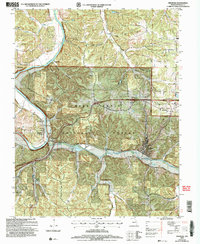
2004 Map of Newburg
USGS Topo · Published 2006About this map
The Gasconade River and Little Piney Creek converge in this section of Phelps County, creating a landscape defined by deep valleys like Tick Hollow and Fable Hollow. The railroad legacy of the region is centered on Newburg, once a vital division point, where the Burlington Northern Santa Fe line continues to parallel the creek. The transition from river-bottom settlements to the uplands of the Mark Twain National Forest is evident in the placement of older landmarks such as Mungy Sch and the New Home Ch.
Find a feature on this map
42 named features on this map. Tap any name to fly to it.
Don’t see what you’re looking for? This feature index may not catch every label — zoom into the map to look around manually.
Map Details
Editions of this 2004 Newburg Map
This is the sole edition of this map. No revisions or reprints were ever made.
Other maps of this area

1888 · Tuscumbia
USGS Topo · 1:125,000

1894 · Tuscumbia
USGS Topo · 1:125,000

1912 · Rolla
USGS Topo · 1:62,500

1936 · Waynesville
USGS Topo · 1:48,000

1937 · Vienna
USGS Topo · 1:62,500

1938 · Vienna
USGS Topo · 1:48,000

1942 · Waynesville
USGS Topo · 1:62,500

1944 · Waynesville
USGS Topo · 1:62,500

1947 · Jefferson City
USGS Topo · 1:250,000

1948 · Tavern
USGS Topo · 1:62,500