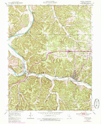
1950 Map of Newburg
USGS Topo · Published 1985About this map
Little Piney Creek winds through the heart of the Mark Twain National Forest, tracing a path between the settlements of Newburg and Arlington. This 1950 survey, with mid-1980s updates, illustrates the geographic relationship between the historic river-town sites and the arrival of modern infrastructure, most notably the path of Interstate 44 cutting across Pea Ridge. The Burlington Northern railroad follows the low ground along the creek, supporting the town of Newburg, where a water tank and localized cemeteries like Newburg Cem and Kitchell Cem mark the community's footprint.
Find a feature on this map
32 named features on this map. Tap any name to fly to it.
Don’t see what you’re looking for? This feature index may not catch every label — zoom into the map to look around manually.
Map Details
Editions of this 1950 Newburg Map
4 editions found

Other maps of this area

1888 · Tuscumbia
USGS Topo · 1:125,000

1894 · Tuscumbia
USGS Topo · 1:125,000

1912 · Rolla
USGS Topo · 1:62,500

1936 · Waynesville
USGS Topo · 1:48,000

1937 · Vienna
USGS Topo · 1:62,500

1938 · Vienna
USGS Topo · 1:48,000

1942 · Waynesville
USGS Topo · 1:62,500

1944 · Waynesville
USGS Topo · 1:62,500

1947 · Jefferson City
USGS Topo · 1:250,000

1948 · Tavern
USGS Topo · 1:62,500