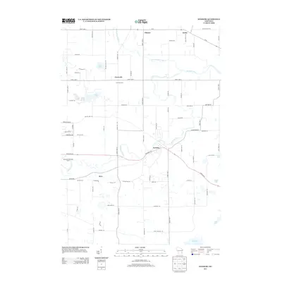
2013 Map of Newburg
USGS Topo · Published 2013About this map
The Milwaukee River winds through this section of Washington County, anchoring a series of small, dispersed settlements including Newburg, Fillmore, and Kohler. The landscape is a mix of agricultural heritage and modern utility, as evidenced by the namesake Cheeseville Dairy in Cheeseville and the presence of the West Bend Municipal Airport on the western edge. This map documents a transitional geography where traditional dairy industry sites like Decorah Farm and local crossroads such as Myra sit amidst a network of glacial lakes, including Erler Lake, Green Lake, and Long Lake. The arterial connection of Wi-84 and State Road 33 E facilitates movement between these rural hubs, while the N Br Milwaukee River carves a path through the northern plains of the quadrangle.
Find a feature on this map
72 named features on this map. Tap any name to fly to it.
Don’t see what you’re looking for? This feature index may not catch every label — zoom into the map to look around manually.
Map Details
Editions of this 2013 Newburg Map
This is the sole edition of this map. No revisions or reprints were ever made.
Other maps of this area

1892 · Port Washington
USGS Topo · 1:62,500

1904 · West Bend
USGS Topo · 1:62,500

1904 · Port Washington
USGS Topo · 1:62,500

1954 · Sheboygan Falls
USGS Topo · 1:62,500

1954 · Milwaukee
USGS Topo · 1:250,000

1955 · Kewaskum
USGS Topo · 1:62,500

1957 · Madison
USGS Topo · 1:250,000

1958 · Milwaukee
USGS Topo · 1:250,000

1959 · Port Washington West
USGS Topo · 1:24,000
1959 · Cedarburg
USGS Topo · 1:24,000