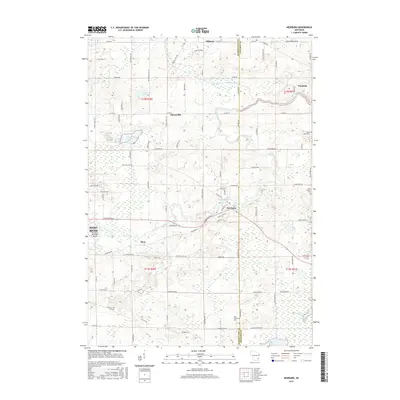
2015 Map of Newburg
USGS Topo · Published 2015About this map
The Milwaukee River and its North Branch wind through the borderlands of Washington and Ozaukee Counties, anchoring a landscape defined by small crossroads settlements and glacial hydrology. This 2015 survey reveals the enduring rural character of towns like Newburg, Fillmore, and Waubeka, while the eastern edge of West Bend and the West Bend Municipal Airport show modern development pressing from the west. Genealogists and local researchers will find several well-documented burial sites, including Saint Johns Cem, Saint Finbars Cem, and Saint Augustine Cem, which mark the early Catholic heritage of the region. Significant ecological features like the Cedarburg Bog and various kettle lakes such as Green Lake, Erler Lake, and Long Lake highlight the post-glacial terrain that has shaped the agriculture and layout of communities like Cheeseville and Myra.
Find a feature on this map
97 named features on this map. Tap any name to fly to it.
Don’t see what you’re looking for? This feature index may not catch every label — zoom into the map to look around manually.
Map Details
Editions of this 2015 Newburg Map
This is the sole edition of this map. No revisions or reprints were ever made.
Other maps of this area

1892 · Port Washington
USGS Topo · 1:62,500

1904 · West Bend
USGS Topo · 1:62,500

1904 · Port Washington
USGS Topo · 1:62,500

1954 · Sheboygan Falls
USGS Topo · 1:62,500

1954 · Milwaukee
USGS Topo · 1:250,000

1955 · Kewaskum
USGS Topo · 1:62,500

1957 · Madison
USGS Topo · 1:250,000

1958 · Milwaukee
USGS Topo · 1:250,000

1959 · Port Washington West
USGS Topo · 1:24,000
1959 · Cedarburg
USGS Topo · 1:24,000