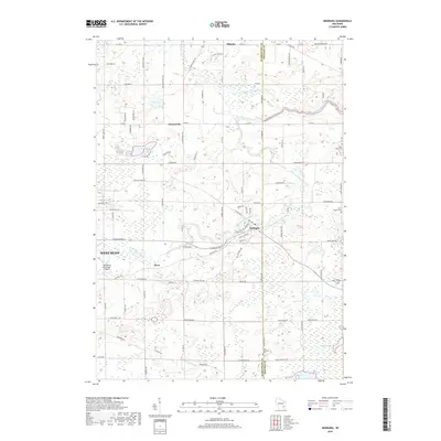
2018 Map of Newburg
USGS Topo · Published 2018About this map
The Milwaukee River and its North Branch wind through this landscape on the border of Washington and Ozaukee counties. Centered on the village of Newburg, the area retains a distinct rural character defined by small settlements like Fillmore, Cheeseville, and Myra. Local history is anchored by numerous parish burial sites, including Saint Johns Cem and Saint Finbars Cem, reflecting the early community centers of the region. Toward the south, the expansive Cedarburg Bog dominates the terrain, offering a stark contrast to the developed outskirts of West Bend and the West Bend Municipal Airport. The map documents a network of historic rural routes, from Trading Post Trl to Boltonville Rd, which continue to connect these long-established agricultural and residential pockets.
Find a feature on this map
92 named features on this map. Tap any name to fly to it.
Don’t see what you’re looking for? This feature index may not catch every label — zoom into the map to look around manually.
Map Details
Editions of this 2018 Newburg Map
This is the sole edition of this map. No revisions or reprints were ever made.
Other maps of this area

1892 · Port Washington
USGS Topo · 1:62,500

1904 · West Bend
USGS Topo · 1:62,500

1904 · Port Washington
USGS Topo · 1:62,500

1954 · Sheboygan Falls
USGS Topo · 1:62,500

1954 · Milwaukee
USGS Topo · 1:250,000

1955 · Kewaskum
USGS Topo · 1:62,500

1957 · Madison
USGS Topo · 1:250,000

1958 · Milwaukee
USGS Topo · 1:250,000

1959 · Port Washington West
USGS Topo · 1:24,000
1959 · Cedarburg
USGS Topo · 1:24,000