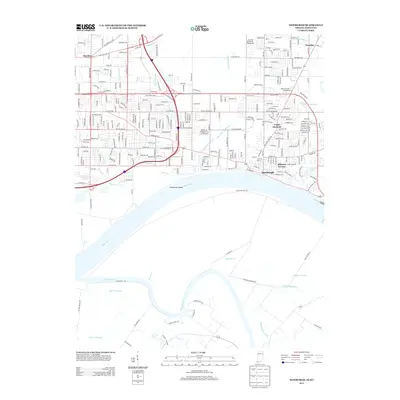
2013 Map of Newburgh
USGS Topo · Published 2013About this map
The Ohio River and the Green River converge south of Newburgh, creating a landscape of complex waterways and floodplains. This 2013 survey illustrates the dense residential development north of the river, where neighborhoods like Hillcrest Terrace and Smythe have expanded alongside historical landmarks such as Camp Brosend. To the south, the terrain shifts dramatically into the wetlands of Kentucky, dominated by the Cypress Slough, Deadman Drain, and the elevated Mound Ridge. The intricate system of drainage, including the Lockwood Ditch and South Willow Pond Ditch, underscores the engineering required to manage the low-lying areas surrounding Threemile Island. Researchers will find a mix of modern suburban sprawl and older rural markers like the Baskett Cemetery, providing a detailed look at the interface between Indiana’s expanding riverfront communities and the preserved natural basins of the Ohio Valley.
Find a feature on this map
280 named features on this map. Tap any name to fly to it.
Don’t see what you’re looking for? This feature index may not catch every label — zoom into the map to look around manually.
Map Details
Editions of this 2013 Newburgh Map
This is the sole edition of this map. No revisions or reprints were ever made.
Other maps of this area

1901 · Haubstadt
USGS Topo · 1:62,500

1902 · Ditney
USGS Topo · 1:125,000

1902 · Boonville
USGS Topo · 1:62,500

1903 · Haubstadt
USGS Topo · 1:62,500

1903 · Patoka
USGS Topo · 1:125,000

1905 · Newburg
USGS Topo · 1:62,500

1914 · Henderson
USGS Topo · 1:48,000

1916 · Henderson
USGS Topo · 1:62,500

1951 · Yankeetown
USGS Topo · 1:24,000

1951 · Spottsville
USGS Topo · 1:24,000