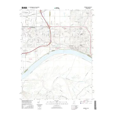
2016 Map of Newburgh
USGS Topo · Published 2016About this map
Newburgh and the eastern edge of Evansville define this portion of the Indiana-Kentucky borderlands, where suburban development meets the engineered drainage of the Ohio River valley. The landscape is marked by a complex network of man-made waterways like Angel Ditch, Willow Pond Ditch, and Akin Ditch, reflecting over a century of efforts to reclaim fertile bottomlands. These channels converge toward the Ohio River, which separates Indiana from Henderson County, Kentucky, at Threemile Island. Local history is preserved in small family and community burial grounds scattered across the quadrangle, including Rose Hill, Casey Cem, and the uniquely named Brickwall Cem. The presence of institutions like Trinity College of the Bible near Camp Brosend indicates the area's role as a regional center for education and religion. Farther south, the meandering Green River and the lowlands of Cypress Slough highlight the riparian character of the Kentucky side of the river.
Find a feature on this map
108 named features on this map. Tap any name to fly to it.
Don’t see what you’re looking for? This feature index may not catch every label — zoom into the map to look around manually.
Map Details
Editions of this 2016 Newburgh Map
This is the sole edition of this map. No revisions or reprints were ever made.
Other maps of this area

1901 · Haubstadt
USGS Topo · 1:62,500

1902 · Ditney
USGS Topo · 1:125,000

1902 · Boonville
USGS Topo · 1:62,500

1903 · Haubstadt
USGS Topo · 1:62,500

1903 · Patoka
USGS Topo · 1:125,000

1905 · Newburg
USGS Topo · 1:62,500

1914 · Henderson
USGS Topo · 1:48,000

1916 · Henderson
USGS Topo · 1:62,500

1951 · Yankeetown
USGS Topo · 1:24,000

1951 · Spottsville
USGS Topo · 1:24,000