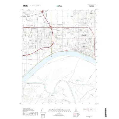
2019 Map of Newburgh
USGS Topo · Published 2019About this map
The Ohio River serves as the prominent natural boundary between Indiana and Kentucky in this 2019 survey, defining the industrial and residential landscape of the Evansville periphery. North of the river, the terrain is shaped by an intricate system of drainage channels including Nurenbern Ditch, Akin Ditch, and Angel Ditch, which navigate the low-lying areas near Threemile Island. Local history is preserved in numerous burial grounds scattered across the quadrangle, from the substantial Park Lawn Cem in the west to the more secluded Brickwall Cem and Baskett Cem further south and east. The transition from the urban reach of eastern Evansville to the smaller settlements of Newburgh, Paradise, and Smythe is bridged by established transit corridors like E Lloyd Expy and Oak Grove Rd, while the Green River meanders through the southern bottomlands of Henderson County.
Find a feature on this map
59 named features on this map. Tap any name to fly to it.
Don’t see what you’re looking for? This feature index may not catch every label — zoom into the map to look around manually.
Map Details
Editions of this 2019 Newburgh Map
This is the sole edition of this map. No revisions or reprints were ever made.
Other maps of this area

1901 · Haubstadt
USGS Topo · 1:62,500

1902 · Ditney
USGS Topo · 1:125,000

1902 · Boonville
USGS Topo · 1:62,500

1903 · Haubstadt
USGS Topo · 1:62,500

1903 · Patoka
USGS Topo · 1:125,000

1905 · Newburg
USGS Topo · 1:62,500

1914 · Henderson
USGS Topo · 1:48,000

1916 · Henderson
USGS Topo · 1:62,500

1951 · Yankeetown
USGS Topo · 1:24,000

1951 · Spottsville
USGS Topo · 1:24,000