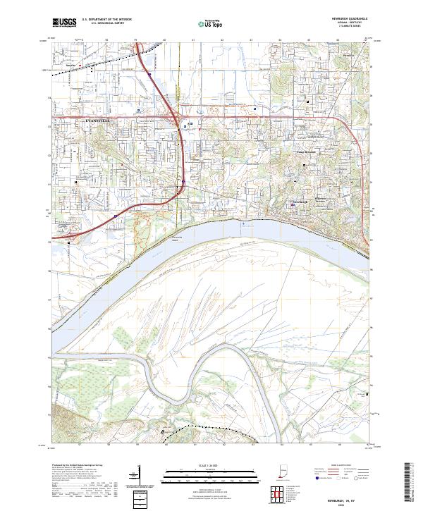
2022 Map of Newburgh
USGS Topo · Published 2022About this map
The Ohio River forms a wide, sweeping bend that separates Indiana from Kentucky at the junction of Vanderburgh Co and Warrick Co. Along the northern bank, the town of Newburgh sits prominently overlooking the river, characterized by a grid of streets including W Main St and E Water St, with residential expansion reaching into Hillcrest Terrace. Further inland, Camp Brosend and Paradise mark the transition toward the suburban outskirts of Evansville.
Find a feature on this map
57 named features on this map. Tap any name to fly to it.
Don’t see what you’re looking for? This feature index may not catch every label — zoom into the map to look around manually.
Map Details
Editions of this 2022 Newburgh Map
This is the sole edition of this map. No revisions or reprints were ever made.
Other maps of this area

1901 · Haubstadt
USGS Topo · 1:62,500

1902 · Ditney
USGS Topo · 1:125,000

1902 · Boonville
USGS Topo · 1:62,500

1903 · Haubstadt
USGS Topo · 1:62,500

1903 · Patoka
USGS Topo · 1:125,000

1905 · Newburg
USGS Topo · 1:62,500

1914 · Henderson
USGS Topo · 1:48,000

1916 · Henderson
USGS Topo · 1:62,500

1951 · Yankeetown
USGS Topo · 1:24,000

1951 · Spottsville
USGS Topo · 1:24,000