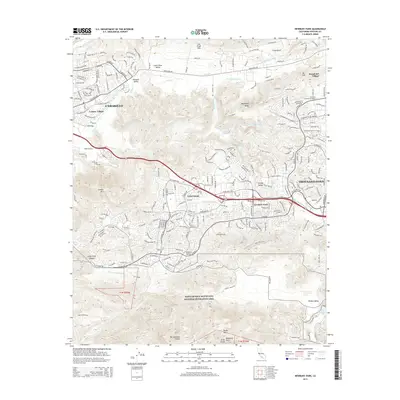
2015 Map of Newbury Park
USGS Topo · Published 2015About this map
Newbury Park and the developed Thousand Oaks corridor sit at the center of this 2015 survey, illustrating the complex suburban growth of the Conejo Valley. The landscape is defined by its dramatic elevation changes, ranging from the residential blocks of Casa Conejo to the protected wilderness of the Santa Monica Mountains National Recreation Area. Higher peaks such as Boney Mtn and Conejo Mtn frame the settled valleys, while California Lutheran University serves as a major institutional anchor in Mountclef Village. The map captures the sophisticated road network of Camarillo and its neighbors, including the private streets of Leisure Village, alongside the natural drainage systems of Arroyo Santa Rosa and Arroyo Conejo. Southward, the terrain becomes increasingly steep as it transitions into the National Recreation Area, where landmarks like Echo Cliffs and Balanced Rock overlook Big Sycamore Canyon.
Find a feature on this map
98 named features on this map. Tap any name to fly to it.
Don’t see what you’re looking for? This feature index may not catch every label — zoom into the map to look around manually.
Map Details
Editions of this 2015 Newbury Park Map
This is the sole edition of this map. No revisions or reprints were ever made.
Other maps of this area

1900 · Triunfo Pass
USGS Topo · 1:62,500

1900 · Piru
USGS Topo · 1:62,500

1903 · Santa Paula
USGS Topo · 1:62,500

1903 · Camulos
USGS Topo · 1:125,000

1904 · Hueneme
USGS Topo · 1:62,500

1921 · Piru
USGS Topo · 1:62,500

1921 · Triunfo Pass
USGS Topo · 1:62,500

1932 · Russell Valley
USGS Topo · 1:24,000

1941 · Piru
USGS Topo · 1:62,500

1942 · Santa Paula
USGS Topo · 1:62,500