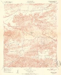
1951 Map of Newbury Park
USGS Topo · Published 1951About this map
Conejo Valley serves as the central corridor for this 1951 survey, a time when the region was primarily defined by agricultural valleys and early residential clusters. The map details the transition from the rolling terrain of Las Posas Hills and Santa Rosa Valley down to the established settlement of Newbury Park. Early local infrastructure is prominent, including the Newbury Park Academy, Timber Sch, and the riverside neighborhood of Ven-tu Park.
Find a feature on this map
37 named features on this map. Tap any name to fly to it.
Don’t see what you’re looking for? This feature index may not catch every label — zoom into the map to look around manually.
Map Details
Editions of this 1951 Newbury Park Map
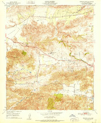
2 editions found
Other maps of this area

1900 · Triunfo Pass
USGS Topo · 1:62,500

1900 · Piru
USGS Topo · 1:62,500

1903 · Santa Paula
USGS Topo · 1:62,500

1903 · Camulos
USGS Topo · 1:125,000

1904 · Hueneme
USGS Topo · 1:62,500

1921 · Piru
USGS Topo · 1:62,500

1921 · Triunfo Pass
USGS Topo · 1:62,500

1932 · Russell Valley
USGS Topo · 1:24,000

1941 · Piru
USGS Topo · 1:62,500

1942 · Santa Paula
USGS Topo · 1:62,500