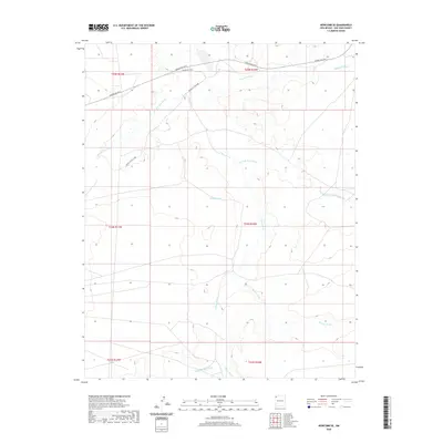
2020 Map of Newcomb SE
USGS Topo · Published 2020About this map
The Chaco River drainage system dominates this portion of the San Juan Basin, revealing a landscape defined by seasonal water flow and tribal infrastructure. In this 2020 survey, the braided channels of Hunter Wash and Captain Tom Wash converge toward the main river valley, illustrating the complex hydrology of the high desert. The transportation network is specifically anchored by Bureau of Indian Affairs routes, including Indian Svc Rte 5 and Indian Svc Rte 5008, which facilitate movement across the arid plains. Notable named geographical features like Teec-ni-di-tso Wash and Arroyo Medio provide critical reference points for local history and land management within the Shiprock Agency region, where the interplay of modern service roads and ancient alluvial paths remains central to the area's geography.
Find a feature on this map
15 named features on this map. Tap any name to fly to it.
Don’t see what you’re looking for? This feature index may not catch every label — zoom into the map to look around manually.
Map Details
Editions of this 2020 Newcomb SE Map
This is the sole edition of this map. No revisions or reprints were ever made.
Other maps of this area

1889 · Chaco
USGS Topo · 1:250,000

1892 · Chaco
USGS Topo · 1:250,000

1927 · Sulphur Spring
USGS Topo · 1:96,000

1928 · Kirtland
USGS Topo · 1:125,000

1932 · Kirtland
USGS Topo · 1:125,000

1954 · Shiprock
USGS Topo · 1:250,000

1958 · Shiprock
USGS Topo · 1:250,000

1959 · Shiprock
USGS Topo · 1:250,000
1966 · Sheep Springs
USGS Topo · 1:24,000
1966 · Newcomb NE
USGS Topo · 1:24,000