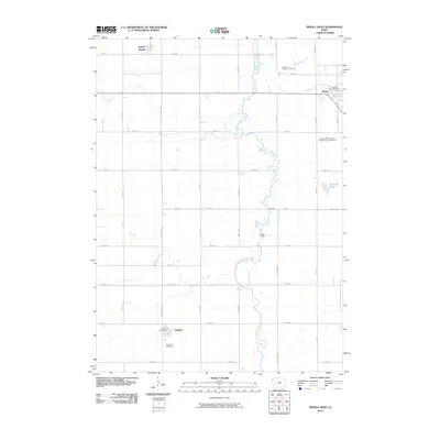
2010 Map of Newell West
USGS Topo · Published 2010About this map
The North Raccoon River meanders through this agricultural landscape in Buena Vista County, defining the drainage patterns for the surrounding farmland. This area is anchored by the established settlements of Newell, Nemaha, and Sulphur Springs, each serving as a focal point for the local rural community. The presence of the Iowa State University Allee Experimental Farm indicates a legacy of agricultural research and development in the region. Local heritage is preserved at sites like the Newell Catholic Cemetery and the Nemaha Cemetery, while community services are represented by the Newell Post Office and Nemaha Post Office. Waterways such as Prairie Creek, Outlet Creek, and Buck Run cut through the grid of section roads, illustrating how the natural topography of the Iowa plains interacts with the rigid geometric surveying of the Midwest. Small natural features like Pleasant Lake and the Vogel Access provide glimpses into the local environmental character.
Find a feature on this map
34 named features on this map. Tap any name to fly to it.
Don’t see what you’re looking for? This feature index may not catch every label — zoom into the map to look around manually.
Map Details
Editions of this 2010 Newell West Map
This is the sole edition of this map. No revisions or reprints were ever made.
Other maps of this area

1954 · Fort Dodge
USGS Topo · 1:250,000

1957 · Fort Dodge
USGS Topo · 1:250,000

1958 · Fort Dodge
USGS Topo · 1:250,000

1979 · Lakeside
USGS Topo · 1:24,000

1979 · Storm Lake
USGS Topo · 1:24,000

1979 · Varina
USGS Topo · 1:24,000

1979 · Newell West
USGS Topo · 1:24,000

1979 · Storm Lake NE
USGS Topo · 1:24,000

1979 · Newell East
USGS Topo · 1:24,000

1980 · Sac City East
USGS Topo · 1:24,000