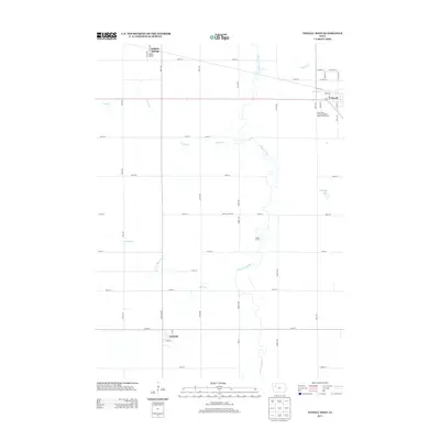
2013 Map of Newell West
USGS Topo · Published 2013About this map
The N Raccoon River winds through this agricultural landscape in Buena Vista County, defining the drainage patterns of a region deeply tied to research and cultivation. The presence of the Iowa State University Allee Experimental Farm south of Newell highlights the area's significance to Iowa’s long-standing tradition of agricultural science. To the west, the small community of Nemaha sits at the intersection of Maple St and 157th Ave, while Sulphur Springs marks the northwestern corner of the quadrangle. The terrain is largely defined by a grid of rural section roads and small watercourses such as Buck Run, Outlet Cr, and Prairie Cr. For those interested in public lands, Vogel Access provides a focused point of entry to the river corridor north of 180th St, while Pleasant Lake serves as a distinct hydrological feature in the eastern section of the map.
Find a feature on this map
49 named features on this map. Tap any name to fly to it.
Don’t see what you’re looking for? This feature index may not catch every label — zoom into the map to look around manually.
Map Details
Editions of this 2013 Newell West Map
This is the sole edition of this map. No revisions or reprints were ever made.
Other maps of this area

1954 · Fort Dodge
USGS Topo · 1:250,000

1957 · Fort Dodge
USGS Topo · 1:250,000

1958 · Fort Dodge
USGS Topo · 1:250,000

1979 · Lakeside
USGS Topo · 1:24,000

1979 · Storm Lake
USGS Topo · 1:24,000

1979 · Varina
USGS Topo · 1:24,000

1979 · Newell West
USGS Topo · 1:24,000

1979 · Storm Lake NE
USGS Topo · 1:24,000

1979 · Newell East
USGS Topo · 1:24,000

1980 · Sac City East
USGS Topo · 1:24,000