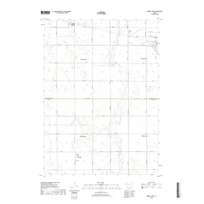
2018 Map of Newell West
USGS Topo · Published 2018About this map
Newell anchors the northeastern corner of this agricultural landscape at the edge of the Des Moines Lobe. The township grid is defined by a dense network of gravel and paved roads, including Co Hwy M50 and Co Rd D15, which connect small communities like Nemaha and Sulphur Springs. These settlements reflect the enduring rural infrastructure of northwestern Iowa, with established sites such as the Nemaha Cem and Newell Catholic Cem providing important touchstones for local genealogical research.
Find a feature on this map
49 named features on this map. Tap any name to fly to it.
Don’t see what you’re looking for? This feature index may not catch every label — zoom into the map to look around manually.
Map Details
Editions of this 2018 Newell West Map
This is the sole edition of this map. No revisions or reprints were ever made.
Other maps of this area

1954 · Fort Dodge
USGS Topo · 1:250,000

1957 · Fort Dodge
USGS Topo · 1:250,000

1958 · Fort Dodge
USGS Topo · 1:250,000

1979 · Lakeside
USGS Topo · 1:24,000

1979 · Storm Lake
USGS Topo · 1:24,000

1979 · Varina
USGS Topo · 1:24,000

1979 · Newell West
USGS Topo · 1:24,000

1979 · Storm Lake NE
USGS Topo · 1:24,000

1979 · Newell East
USGS Topo · 1:24,000

1980 · Sac City East
USGS Topo · 1:24,000