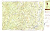
1984 Map of Newfane
USGS Topo · Published 1984About this map
The West River and Connecticut River carve through the landscape of Windham County, Vermont, and the western edge of New Hampshire in this 1980s topographical study. Small villages like Newfane, Williamsville, and West Dummerston are linked by winding roads that trace the valleys between Putney Mountain and Black Mountain. The map captures the region's agricultural and rural character, evidenced by expansive tracts like Canoe Meadow and Kathan Meadows Road.
Find a feature on this map
77 named features on this map. Tap any name to fly to it.
Don’t see what you’re looking for? This feature index may not catch every label — zoom into the map to look around manually.
Map Details
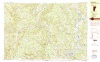
Editions of this 1984 Newfane Map
2 editions found
Other maps of this area

1889 · Wilmington
USGS Topo · 1:62,500

1891 · Wilmington
USGS Topo · 1:62,500

1891 · Brattleboro
USGS Topo · 1:62,500

1893 · Brattleboro
USGS Topo · 1:62,500

1894 · Londonderry
USGS Topo · 1:62,500

1898 · Keene
USGS Topo · 1:62,500

1899 · Londonderry
USGS Topo · 1:62,500

1899 · Wilmington
USGS Topo · 1:62,500

1927 · Bellows Falls
USGS Topo · 1:48,000

1930 · Saxtons River
USGS Topo · 1:48,000